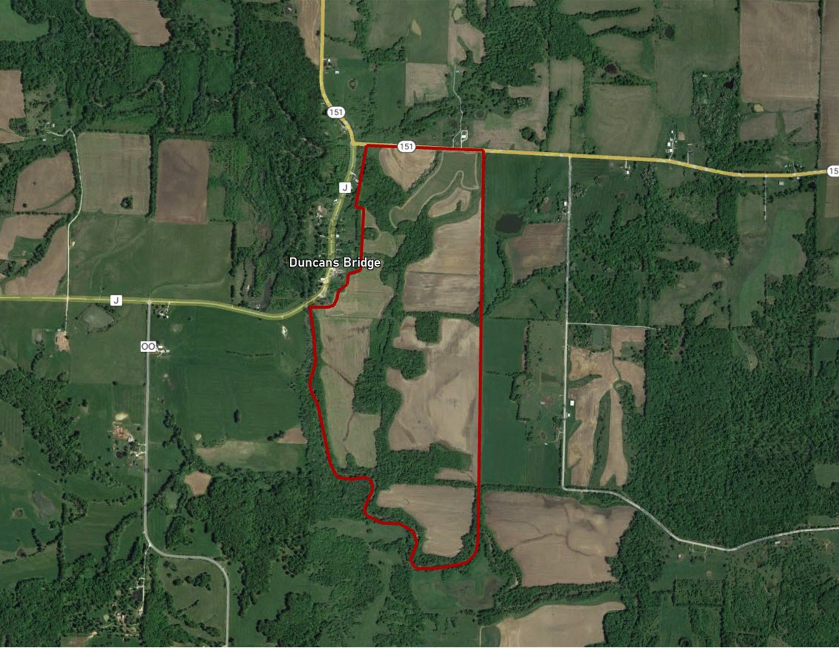
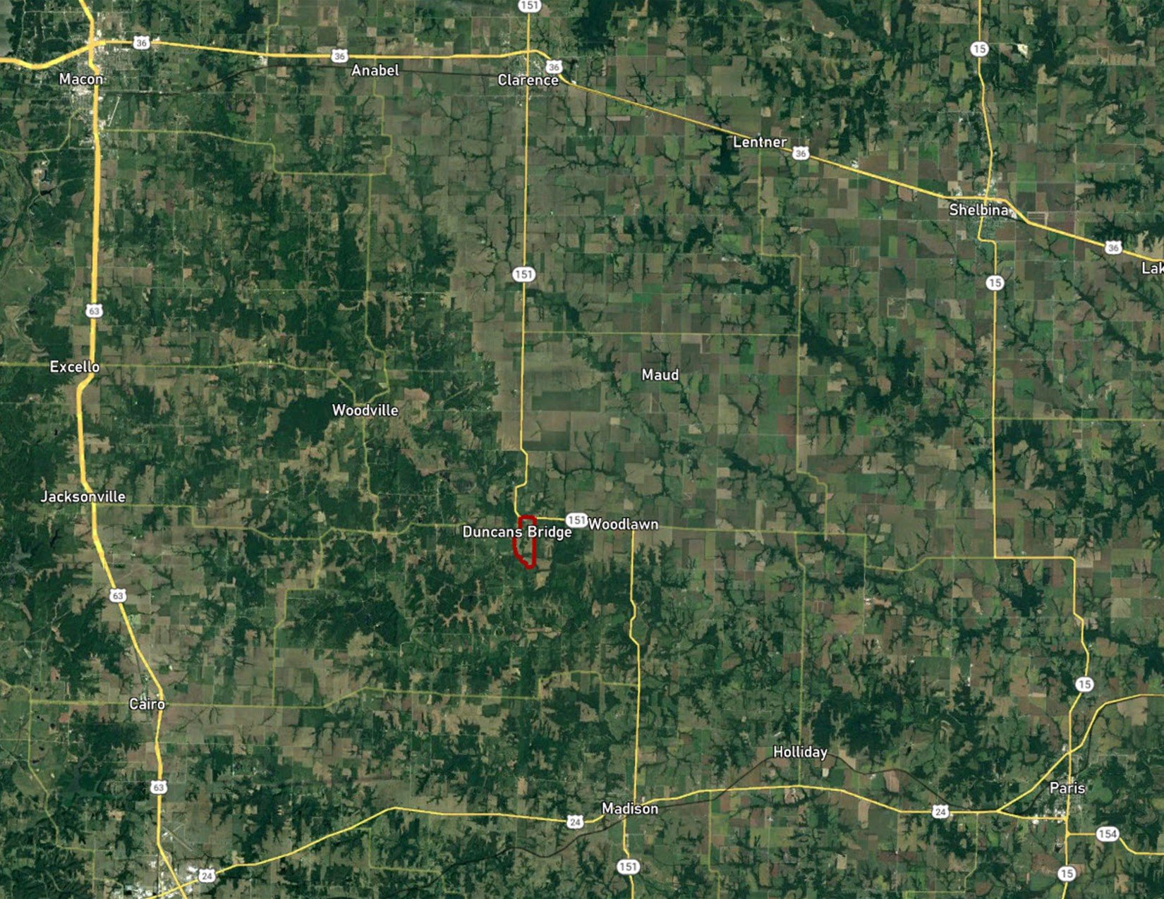
Monroe County, MO
Hwy. 151
Dunkan's Bridge, MO 65263
325
Acres M/L
$2,150,000
Listing #16868
Contact
Douglas R. Yegge
563.320.9900
Doug@PeoplesCompany.com
View Agent's Listings
PROPERTY INFO
Description
Peoples Company is proud to present 325 acres m/l of quality farmland located in Monroe County, Missouri. This farm consists of 325 acres m/l with 230 estimated cropland acres. The farm carries a NCCPI of 74.6. The farm primarily consists of Piopolis silty clay loam & Blackoar silt loam. The property is located in Sections 8, 9, 17, and 16 of Woodlawn Township in Monroe County, Missouri. This property would be a great add-on to an existing farming operation or a smart investment for the buyer looking to diversify their portfolio.
*Seller is a licensed real estate Broker in the State of Missouri.
Legal Description
Part of the NE ¼ NE ¼; part of the SE ¼ NE ¼; NE ¼ SE ¼; part of the SE ¼ SE ¼, Section 8. The W ½ NW ¼; part of the SE ¼ NW ¼; part of the NE ¼ SW ¼; W ½ SW ¼; part of the SE ¼ SW ¼ of Section 9. Part of the NW ¼ NW ¼; part of the NE ¼ NW ¼ of Section 16. Part of the NE ¼ NW ¼ of Section 17, all being in Township 55 North, Range 12 West, Monroe County, Missouri. Exact legal description to be taken from Abstract.
Farm Details
DCP Cropland Acres: 222.12
Corn Base: 42.6 Acres with a PLC Yield of 73
Wheat Base: 52.3 Acres with a PLC Yield of 44
Soybean Base: 118.2 Acres with a PLC Yield of 23
Grain Sorghum Base: .10 Acres with a PLC Yield of 74
- Parcel Number: 06-2.2-09-0-00-004.000, 06-5.0-16-0-00-002.000, 06-4.2-17-0-00-001.000
- General Area: Duncan's Bridge, MO
- Gross Taxes: $875.20
- Possession: As agreed
- Terms: Cash, Conventional, Exchange
Directions
Southeast edge of Duncans Bridge, Missouri.
INTERACTIVE MAP
Use the Interactive Map to explore the property's regional location. Zoom in and out to see the property's surroundings and toggle various mapping layers on and off in the Map Layer Menu.